|
31.5.2003 Tahiti, French Polynesia
We got a new bolt for the mast and now the rig is fine again. After
a week in the city centre we moved for a couple of days to Marina Taina,
located five miles away from the town. First we anchored, but the last
day we were able to lend the marina berth of Henry, a
Finnish guy who has been living five years in Papeete. He had seen our
flag in town.
We were waiting for some reindeer meat, sent to us from home. We have
had that excellent dried meat onboard all the time except in New
Zealand, where it's not allowed to bring meat. The package arrived, we
cleared out, took tax-free diesel (0.60 e/litre, normally 1 euro/litre!)
and filled the watertanks. French Polynesia is very expensive, so we
bought mainly fresh vegetables and fruit: this time ananas, papaya,
pomelo, banana and lime. And two kilos emmenthal cheese (10 e/kg) which
would be anyway more expensive in the States.
Now we are ready to start towards Hawaii, 2400 miles away.
Again we might have to do a curve to east to avoid headwinds, the NE
tradewinds, in the end.
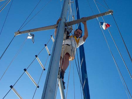
Hannu fixing the new bolt
7.6.2003 Pacific Ocean 5 07 S 148 21 W
The last week we have been wishing that we would be far away from
the sea and sailing, by a calm lake in the forest. We both have been on
a very bad mood, not enjoying the sailing. I cannot remember any other
time we would have felt this way. We have not argued with each other,
just feeling miserable both. But. The weather has not been bad, there
hasn't been any accidents, and we have made an acceptable 115 miles per
day. What's the reason?
The weather has been very capricious: first calm, then 40 knots with
rain, which made us to pass the low and dangerous Tuamotus from west
instead of sailing through them in the night. This way we lost the
advantage of the southerly wind to get some easting. After that only
gusty headwinds and showers several days. Life has been reefing and
un-reefing, getting wet and drying things. Tradewinds should blow from
SE, and with them we should sail to NE, but the wind has been NE. We are
on the edge of all weather fax map areas and cannot get a proper
forecast. Everything is muggy, sweatty and damp. It's hot inside because
the hatches have to be closed. Skin is constantly moist and the bunk is
wet of sweat.
However, all this is nothing but uncomfortable. We seemed to have
started this leg with a wrong attitude. We expected an "easy"
passage with smooth tradewinds, at least in the beginning. We thought we
need the guts during the last 600 miles, when wind is stronger and the
hurricane season brings it's own excitement. And this wrong attitude has
made the last week more difficult than the last leg with gales and
rig-problems! Interesting.
The last two days we have had weak winds, and we have mostly
motorsailed. Even if the motoring is never nice, at least we have
proceeded to the right direction. This has cheered us up, and also all
the moaning for no reason really starts to be amusing. So this is how to
make an easy sailing difficult.
There is 1500 miles to Hawaii.
We saw two minky whales just when we left. They were 5-6 metres long,
with dark grey backs and light coloured bellys. The paired blowing
holes, one of the characteristics of the baleen whales, were clearly
visible. The whales dived under the bow before they continued their way.
Sometimes a black-and-white fregatt bird is curving above the mast. It
is alone, unlike the gannets, which stay in numerous flocks. These are
brown and skinny, some other species than Sulo, who sailed with us a
year ago.
The first time we had a swordfish on the hook. Two jumps and it was
free. Doubtly we could managed it aboard. But we got a perfect
two-persons two-kilo tuna. It was made at follows:
Tuna-wok
a la Kristiina
a chunk of fresh tuna
a couple of carrots
a small onion
a squash
oil
ginger, white pepper, herbamare-salt
lemon juice, soya, water
Chop the vegetables and fish to mouthfull pieces. Warm the oil
in a wok. Fry onion and carrots first, add fish and squash.
Stir time to time. Season with ginger and white pepper,
carefully with some herbamare. When the tuna is brown, dash in
lemon juice, soya and water. Put the lid on and let cook for
10 minutes. Add some soya to taste. Serve with rice.
|
14.6.2003 Pacific Ocean 9 34 N 147
55 W
The reason for the capricious weather of the beginning of the trip
revealed - and we should have known that: it was the South Pacific
Convergence Zone (SPCZ), similar to the Intertropical
Convergence Zone (ITCZ) near the equator. As the name tells, the SPCZ
lies within the southern hemisphere, and it can be absent for times.
Generally, SPCZ doesn't have calms typical to ITCZ, but otherwise the
weather patterns are similar: gusty winds and rain. Just what we
experienced.
The Intertropical
Convergence Zone, i.e. the doldrums, separates the
northerly and southerly tradewind belts. ITCZ's location and width changes.
East of 160 W (where we are at the moment) it lies almost always north
of equator. We reached the doldrums at the 6th latitude N. It became calm, cloudy and
drizzling. The ITCZ was 3 degrees wide, i.e. 180 miles. At the
latitude 9 N the NE tradewinds started to blow.
Between these two convergence zones we experienced tradewind sailing as
its best. Sea was slight and Kristiina moved on steadily. No rain, only
soft wisps of clouds on the blue sky. We were able to make enough
easting for the future head winds. What a life! Sailing was wonderful
again!
On Tuesday, the 10th of June at 8.16 am we crossed
the equator at point 147 deg 52 min W. No need for Neptunus this
second time, but we had French sparkling wine from Papeete for
breakfast. We had been over a year on the Southern hemisphere. Now the
winds in lows and highs will circulate in a familiar way again, and the
midday sun is shining from south instead of north. Soon we'll see the
North Star, upside down sitting Plough we have already seen for a while.
After the EQ we got a current with us for two days and the miles started to run.
Speed hanged constantly on 7-8 knots and we made an unbelievable 24-hour
record: 178 miles!
We have 700 miles left to Hawaii. This is the most exciting part,
because we are now at the edge of the hurricane area.
Hurricanes develope at the Mexican coast, and do no usually come
west of 140 W, but even Hawaii (155 W) has experienced 6 hurricanes
after 1950, the latest in September 1992. The season is from May to
November. According to statistics, two tropical cyclones are possible in
June of which the other developes to hurricane (wind speed over 64
knots). In July, August and September the possibility is twice as high.
For us an unpleasant statistical feature is, that in the beginning of
the season hurricanes are more likely to move far west, whereas the
later ones keep closer to the shore.
Hurricanes - in other names cyclones or typhoons - exist only in
tropical ocean areas. They born out of thunderclouds, fed by warm (over
26 deg. C) seawater. When they reach landmass or cold seawater they
gradually die. Tropical cyclones have no fronts like normal cyclones
(low pressures). An immature tropical cyclone moves slowly, about 5-10
knots, and also a fully developed hurricane can move relatively slowly,
about 20-25 knots. But the windspeed is another matter. Windspeed in
tropical depression is under 34 knots, in tropical storm 34-64 knots,
and in hurricane over 64 knots (32 m/s).
In addition to the normal weather faxes, Hawaiian and Californian radio
stations send information about hurricanes. So that you don't have to be
ignorant when meeting a hurricane...
Back to earth from the weather systems: BEAUTIFUL
MIDSUMMER to everyone, especially to Sindbad-folks at
Elisaari! We should reach Hawaii on the Midsummer Eve. The phone is on
during the Finnish Midsummer Eve.
22.6.2003 Hilo, Hawaii
On the 19th of June we arrived to Hilo, Hawaii. The log counted 2480
miles, for which we had spent 19 days (an average of 130,5 miles per
day). Two days before our arrival, hurricane Blanca
developed at the coast of California. It moved, however, along the coast
before dying out. In addition to hurricanes, also tsunamis
are a threat in this area. They are huge ocean waves, caused usually by
an underwater earthquake. The city of Hilo has experinced two bad tsunami devastations, in 1946 caused by an earthquake at Aleutians, and
in 1960 at the coast of Chile.
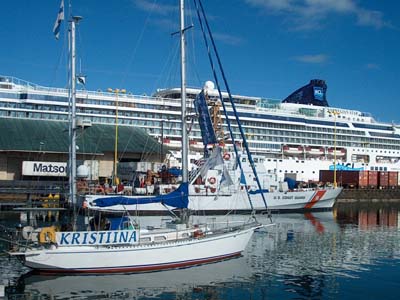
The Hilo yacht harbour is a small basin next to a noisy container
harbour. Here are only four boats, one Canadian, the rest Americans. All
the officials were very friendly. Hannu had to do all the paperwork by
himself because Auli had stepped on a fish hook a couple of days earlier
and couldn't walk. We are allowed to be in the USA 6 months at the time,
which means that our plan to winter in Alaska is impossible.
The town of Hilo is located 2 km away, which is inconvenient for Auli
and her hurted foot. On Friday we kicked there with our Helkama
scooters, walking would have been impossible. All the facilities,
including shops and internet, are in town, near the harbour is only a
small store and a laundry. We have already washed six loads, the normal
job after an ocean passage.
The island of Hawaii is the biggest of the numerous
islands in the Hawaii archipelago, and therefore also called the
Big Island. Hilo is located on the rainy east coast, whereas most of the
tourist activity is on the Kona coast on the west side.
Here are the highest volcanic mountains, active Mauna Loa
(4169 m) and non-active Mauna Kea (4205 m). They rise over
9 km from the sea bottom making them the highest mountains in the world.
We were waiting to see the tops far out at the sea, but the rainy and
cloudy weather prevented it. The only thing we saw was a small strecht
of green shoreline between the rain patches.
|
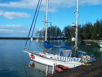
The two sides of Hilo harbour...
|
|
The Hawaii Islands are scattered
along 1400 miles from the easternmost Hawaii (20 N 155 W) almost to the
dateline and 30th latitude. There are alltogether 130 volcanic islands,
atolls and reefs, most of them just tiny spots. The eight biggest
islands are Hawaii (Big Island), Maui,
Oahu, Kauai, Molokai, Lanai, Niihau and Kahoolawe, covering 99 per
cent of the land surface. The capital Honolulu is on Oahu,
as well as Pearl Harbor
navy base.
Hawaii is part of Polynesia, but nowdays the Polynesians make up only a
couple of percents of the population. The islands are a mixture of
people, race and religions - very different from the other Polynesian
islands. The origin of the inhabitants are mainly Japanese, Whites,
Filipinos and Chinese. In 1898, Hawaii became a part of USA, and in 1959
it was made the 50th state of America. The main industries are tourism
and pineapples - well, a slice of pineapple makes an escalope as
Hawaiian. Also coffee and sugar cane are cultivated.

Captain Cook has
been given the honour of being the first white man on Hawaii, in 1778.
He named the place to Sandwitch Islands according to his
Lord-supporter. The islanders knew iron, which they appreciated as an
object of trade, and they also had it in small quantities. This implies
that there had been someone before Cook and his ships, Resolution
and Discovery. Cook himself writes in his diary that it might be
the Spaniards.
Cook ended up to Hawaii on his way from Tahiti to north. He was sailing
the same route than us, only so much more in west, that he run into Christmas
Island. The remote atoll came in sight at the Christmas Eve,
therefore the name. The ships anchored for a week, men catching turtles
and fish.
The voyage from Tahiti (or more preciously from Bora-Bora) to Hawaii
took about one month excluding the stop at the Christmas Island. On the
18th of January they sighted the western island of Kauai.
Cook and his men were welcomed friendly. They anchored for about ten
days, first at Kauai, then at Niihau. Ships stores full
they left for Alaska, looking for the Northwest passage. When the winter
became too hard, Cook decided to return to Hawaii. This time the ships
anchored at Kealakekua Bay
on Hawaii. The Polynesians were friendly again. An annual festival for
the god Lono was going on, and Cook was treated like a god - or
as an guest of honour. After three weeks the ships were ready to leave
again, stores full of roots, fruits and hog meet. They didn't get far,
however, when a storm damaged Resolution's foremast, and they were
forced to return to Hawaii. Now the locals were hostile and the
two-day-stay turned into wrangles and thefts. The stealing of the ship
cutter together with an attempt to take hostages to get it back, ended
up to a fight and finally to the death of captain James Cook in 14.2.1779.
28.6.2003 Hilo, Hawaii
You think that Hawaii is only palm and beatches, but the best attraction
on the Big Island is the Volcanoes
National Park, where much green isn't around. We have been in
some volcanic areas during our trip. In Iceland we walked on the still
steaming slopes of a volcano in Westman Island, and in New
Zealand we hiked through Tongariro. But here we were able
to see - and almost touch - melting lava!
The four kilometres high Mauna Loa erupted from the top
last time in 1984. However, the top isn't the only place where magma
penetrates the surface, along the slopes are several eruption spots, craters
and calderas. Caldera differs from crater not having a crater
channel, but magma is exploding with high pressure, making finally a
large, round "valley". The slopes of Mauna Loa are joined with
an other volcano, Kilauea (1250 m).
.
The caldera of Kilauea
Around the Kilauea
caldera has been built a 18 km long tourist road with
outlook stops. It can either be walked or drove by car.  We
had a rent-car, so we sat comfortably inside the airconditioned
Oldsmobile driving through the moon landscape. Besides the round drive
there is a road all the way down to the shoreline, where lava cuts it
off dramatically. An eruption started on the eastern slope in
1983, and it's still flowing. And this melting, hot lava can be seen
nearby.
Auli's foot was not in a hiking condition, but this was something too
special and temptating as well as peculiar (how come they let tourists
to the area without guidance, isn't that dangerous?!) that we decided to
walk to the place. To reach the hot lava you have to walk an hour and
half over an older lava field. The best time is of course in the
evening, when the lava is glowing in the dark. So we started - with tens
of other tourists - our walk towards the hot glow. We had our sturdy
hiking shoes on and flashlights packed with us, it will be dark when
we'll be coming back. First we went through an area that only a couple
of months ago was a road. The lava here was very different from what we
had seen in Iceland, there it was gravel and hard stones, here it was
shiny and even with round figures. Like fudge or cake dough. The layer
wasn't thick, here and there you could see the road, traffick signs
sticking out of the black lava.

No parking
 Closer the magma the temperature rose. An orange glow was shining
between some stone cracks. And finally we saw it, the fire river in the
middle of black lava field. The area was maybe 10 metres wide and mainly
the glow was covered by the dark layer popping into the surface in some
places. Also near the water edge was a fire "rapid" which was
steaming when it reached the sea.
I considered the heat unpleasant and also a bit frightening, but Hannu
went near the glow edge. Suddenly near him a magma flow started to spurt
out. His leg hair burned, but he hardly noticed it then, so excited he
was with all the three cameras. There were people on the other side of
this new spurt and it looked like they sat on the lava flow. Somebodys
rubber sole was burning.
The night became darker, and the glow more visible. Up in the volcano
slopes were red glows, like giant barbecues. A dense smoke came from the
top, but the only thing we could see, was a red glimmer on the night
sky. There was Pu'u O'o, the top of the eruption.
The experience was wonderful. Now later it feels odd that we have been
so close to molten lava.
In the park visitor's centre we saw a film telling about the birth of
Hawaiian Islands. Before we had believed that the islands have been
formed each by an own underwater eruption, but this isn't the case.
Hawaii is located in the middle of the Pacific platform as well as on
the top of a "hot spot". The island chain was born by one and
same volcanic eruption, and the movement of the platform formed the
separate islands. It has worked like a giant conveyer line, on which
lava - i.e. an island - has spurted between some millions of years. The
islands have formed during 70 millions years. The island of Hawaii is
the youngest, but not last on the line: still under the sea surface is Loihi,
which is growing.

People went very near the lava spurt,
literally sitting on it

The molten lava flow ends to sea
7.7.2003 Molokai, Hawaii
After ten days in Hilo, we left in the evening to the darkening sea.
During the night the trade winds ease and it's best time to cross a
channel between the islands. They can be really windy when the trades
funnel into small sound. Especially the Alenuihaha Channel
between Hawaii and Maui has a bad reputation. When we got nearer the
north tip of Hawaii, the wind gathered some speed, about 25-30 knots,
which lasted long to the leeward side of Maui. Then suddenly it stopped
blowing. We got a small mahi-mahi just before we lost the speed (no need
for fish hook this time!). Our plan was to explore the island of Maui
next, but it doesn't offer good anchorages, all are open both to
wind and swell. We stayed couple of hours resting and swimming in front
of a beach, but in the afternoon the rising swell drove us away. We
continued to the island of Lanai and Manele Bay,
which has a small harbour behind a sea wall. We planned to anchor inside the breakwall, like one big
motor boat, but the harbour master told that the area is
private and they charge 1,25 dollars per foot! For Kristiina that'll be
46,25 per day! So we had to take a slip with 10 dollars a day. Never an achorage has been more expensive than a slip.
Although the harbour is small, it is very busy. The Maui ferry arrives
five times a day. (With the ferry we could have visited Maui and it's
biggest town Lahaina, but that would have costed us 100 dollars, so we
didn't go.) Every day three big catamarans bring a full load of
tourists. A big rubber boat takes divers out, and smaller boats full of
long rodes are for fishing tours.
Lanai was in past owned
by Mr Dole, and the whole island was pineapple fields, but it's present
owner has concentrated on tourism. Lanai has two classy hotels with golf
courses. Besides the hotel guests, tens or maybe even hundreds of
people arrive with charter boats from Maui to swim, snorkel and dive.
Between the hotel and harbour lies a wonderful white sandy beach, which
is also a nature protection area. The town is up in the middle of the
island, where a cooling wind makes the heat more tolerable than down by
the shore. There are about 3000 inhabitants on the island. Only a few
per cents of the land is owned by the local people.

The paradise beach on Lanai. A hotel on the background.
The time on Lanai went by
quickly. Every day we went to the beach to swim and watch surfers.
Perfect for them, there was a high swell warning caused by a storm
somewhere in the south. Towards the end of the week more and more people
came to the beach with their tents, barbecues and cool boxes. The
4th of July, the Independence day, may have increased the amount
of campers. We waited for fireworks, but on Lanai that happened on the
next day, combined with the traditional Pineapple Festival. In the town
park a local band was playing, there was a pineapple eating competition
for kids and a pineapple desert competition for adults. A variety of
stalls were spread out on the lawn. We didn't stay until the fireworks.
The only headache during
these lazy days has been the reporting to customs. We have to report to
the officials by arrival to a new place. The
first stop was in anchor, so we called the Coast Guard by VHF. They
sounded unaware about this reporting system, but after a long and
breaking connection the report was done. But then the weather drove us
away, and we didn't stay on Maui, as we had told a couple of hours
before. On Lanai we tried to phone from a phone box, without success.
The harbour master arrived when we had spent two days in Lanai, telling
that the phones are not working properly. We used her cell phone and
made our report to an official who was slightly annoyed because of the
delay.
On Sunday, the 6th of July, we finally left Lanai and sailed 40 miles to
the west corner of Molokai. Again the wind increased from
calm to 25-30 knots when we reached the channel between the islands.
With two reefs in the main and the genoa we sailed with the wind 6-7
knots. Molokai has a couple of sheltered anchorages and we chose an
abandoned sand harbour. A breakwater shelters from swell, but the east
wind wipes along the shore. Local youth is drinking beer on the shore.
Not a pleasant anchorage. The landscape on Molokai is as dry and dead
as on Lanai. We went for a walk early in the morning, when it still is
cool, but the dusty dirt road wasn't very temptating.
13.7.2003
Honolulu, Hawaii
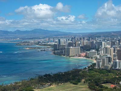 We
were really looking forward to Honolulu, and everything turned out to be
just wonderful - after some troubles. We were near not to get a place
for Kristiina in town, because of the TransPac Race from
Los Angeles. The 1000-slip marina is fully booked. We had to spend a
night in Keehi Lagoon, which is a marina/anchorage 5 miles away. It's
dusty, noisy and ugly. It's located by the airport, next to a quarry
where they crush stone. Surroundings is an industrial area without
facilities or services. It would have been really difficult for us to
get to the town, although Honolulu has an excellent bus service. Auli
phoned tens of desperate calls, and finally Hawaii Yacht Club
offered us a place for a week (17 dollars per day). It's hard to
describe our feelings when we left the smelling industrial area and tied
up to the yacht club dock in the middle of the town, next to Waikiki
Beach. The tiny yacht club area is pleasant. Surrounded by palm
trees and green lawn it's like a green oasis in the middle of the
huge marina. Here are other visiting cruisers as well: illywhacker
from Australia, Chaski from France, SawLeeAh and Star
of Winds from Canada and Jasmine from California. illywhacker
and Chaski have spent the winter in Alaska, so we got a
lot of information, charts and cruising guides. Except of two boats, all
the others are heading south, from where we just arrived, so chart and
information trade has been lively.
|

Hawaii Yacht Club
|
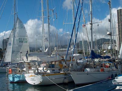
Two coming from, one heading to
Alaska:
Chaski, Illywhacker and Kristiina
|
Bob and May Jane from Jasmine
took us with them around the island by car on the first day. It was
interesting to see other places on Oahu than just Honolulu. About 80 per
cent of the 1 million inhabitants of Hawaii live on Oahu. This island
reminds a lot of Tahiti. Hills are steep and green, the scenery is lush,
and the shoreline is protected by the reef. Difference with the younger
Hawaiian islands is remarkable. We saw first time pineapple fields and
visited a Surf Museum.
In Honolulu we have been wondering the hotel mazes (almost got lost in
one), visited the Maritime Museum, climbed on the top of 232 metres high
Diamond Head, and have taken care of the usual
city-affairs such as developing slides, provisioning and doing the
laundry. Unfortunately we got the place just for one week, so around
Tuesday-Wednesday we have lo leave the Yacht Club.
|

Pineapple grows near the surface,
surrounded by sharp leaves
|
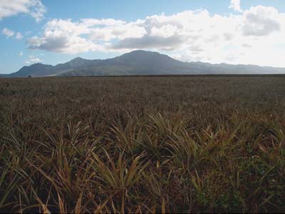
Pineapple fields on Oahu
|
Previous
- Next
|